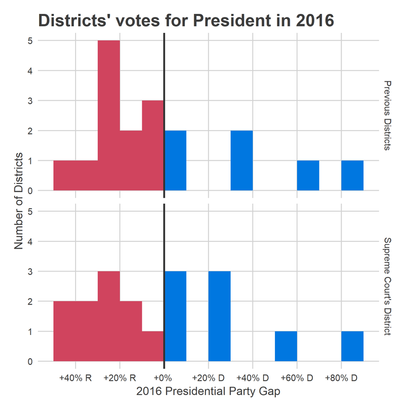
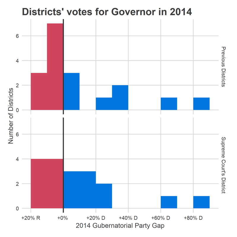
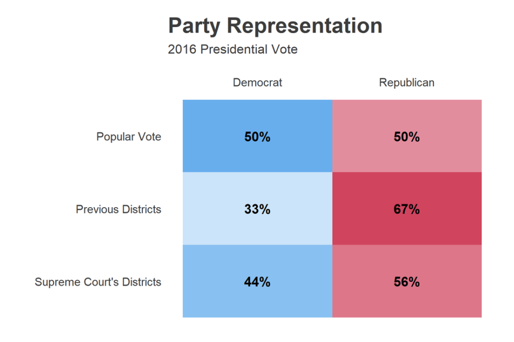
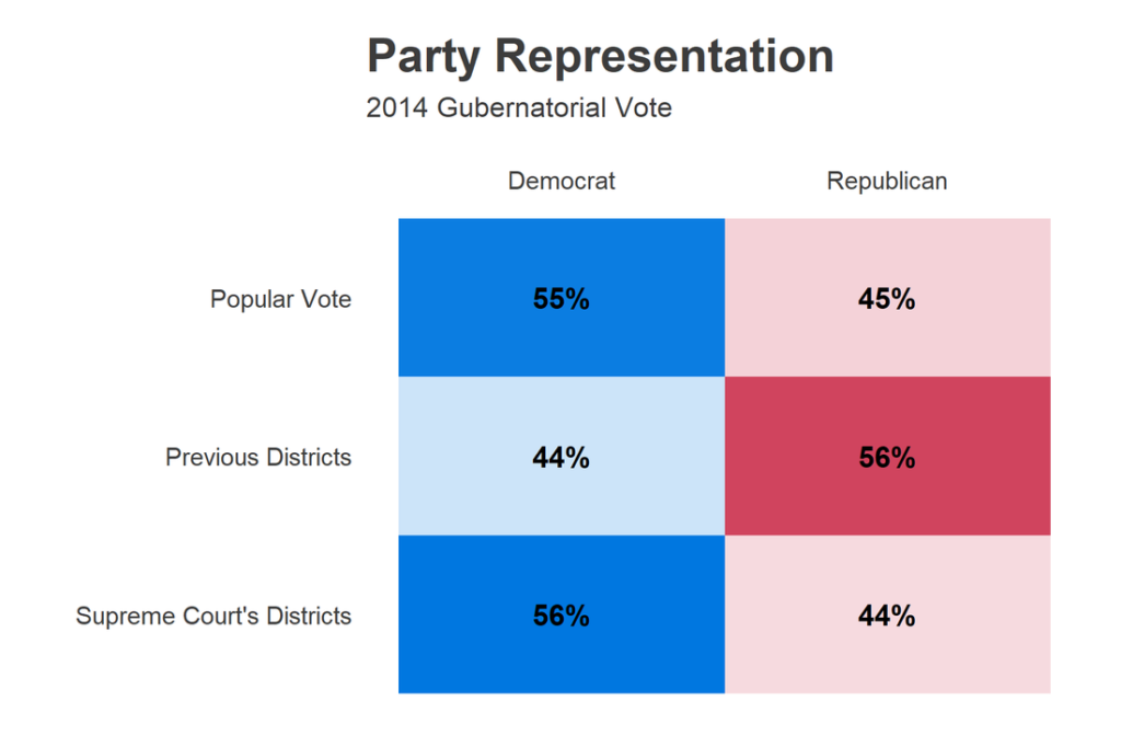
Last weekend, the State Supreme Court announced the new Congressional boundaries for the 2018 election. Even though the GOP immediately challenged them in federal court, these boundaries appear fairer than any of the other maps proposed–by Republicans or Democrats. (NB: I purely define “fairness” as producing districts with partisanship close to the popular vote. I think compactness and county alignment are well-meaning but bad standards).
This week, I’ll be digging into each of the districts in the Philadelphia area, looking at their map, their voting behavior, and their demographics. But first, here are some high-level summaries of the Court’s districts. I’m not going to narrate, but mostly planting the images here for posterity. (Note, these were tweeted out by the @sixtysixwards twitter account. Follow that for the hottest real-time analysis.)


